
GO TAKE A HIKE: OUTDOOR SPOTS NEAR CHICAGO
Looking to get an escape from city life for an afternoon? There are great outdoor spaces close to Chicago where you can stretch your legs, soak up the sunshine, and relax in nature. Whether you want to take public transportation to a green space within the city limits or are willing to drive a few hours to get away, there’s a great spot for you! Just remember to always practice Leave No Trace by packing out your garbage, leaving all plants and rocks where you found them, and respecting wildlife and other visitors.


Willow Springs, IL
The Palos Trail System is located in the southwest suburbs of Chicago and has 42 miles of multi-use trails. This offers recreation opportunities for hikers, mountain bikers, equestrians, and cross-country skiers. The trails wind around wetlands and through woods and prairies. Short trails can be combined into a longer loop or completed on their own for a more leisurely stroll. Be aware that some of the trails cross roads, but the road noise is minimal on the trails.
Chicago, IL
Just east of O’Hare Airport along the Des Plaines River you’ll find the Catherine Chevalier Woods. This forest preserve has wide trails through wooded areas and grassy fields with picnic shelters. Additional forest preserves border the Catherine Chevalier Woods on the north and south, so adventurous walkers can follow the Des Plaines River Trail for many miles. The wooded areas are particularly wonderful to visit during the summer when mature trees shade the trail and make those hot summer days more bearable.
Chicago, IL
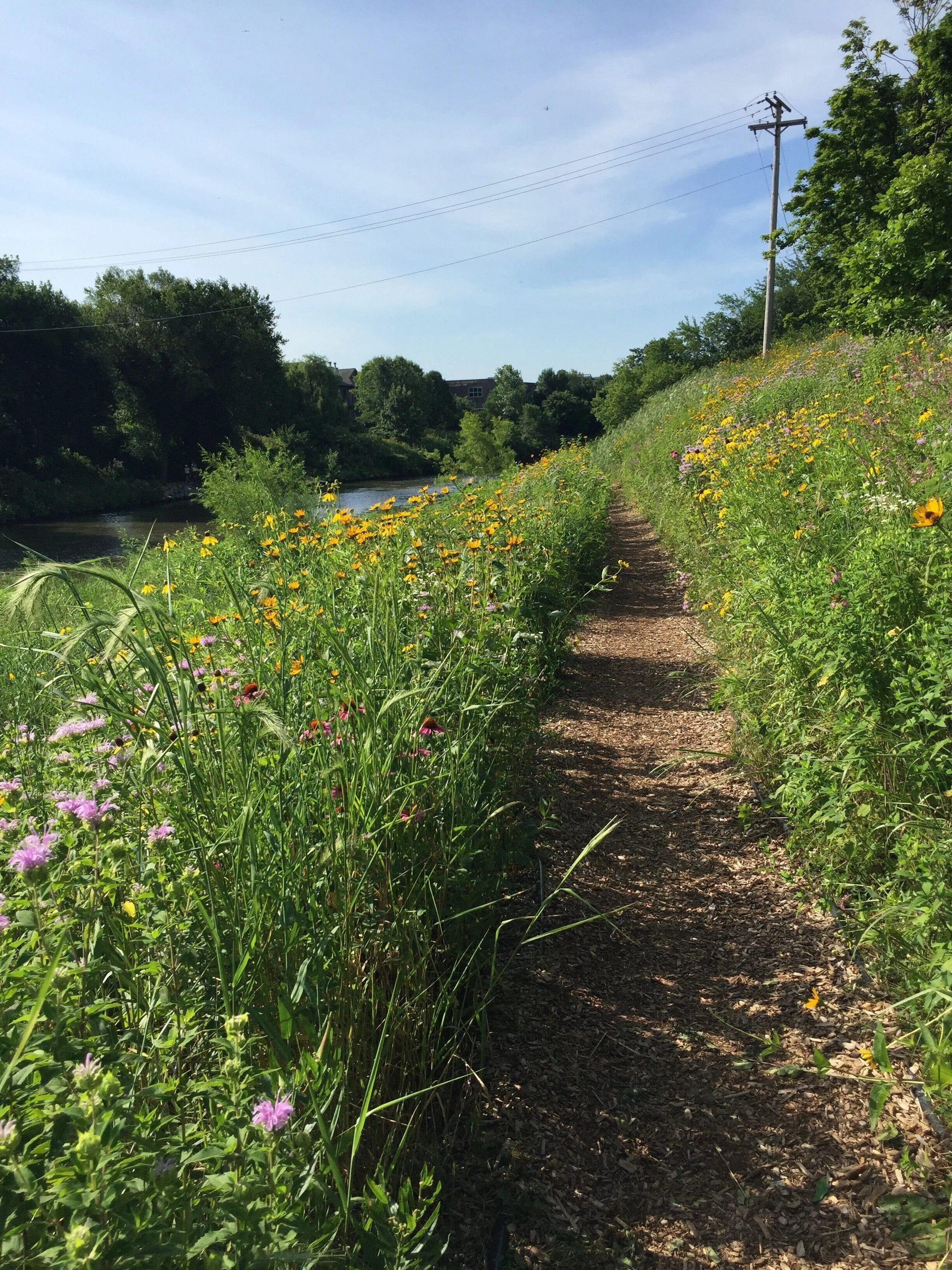
The natural area at Horner Park is an 11 acre section of restored riverbank with prairie plants and a mulched walking trail. It is located on the North Branch of the Chicago River between Montrose Avenue and Irving Park Road and is a short walk from CTA buses and the Brown Line. There is also a parking lot along the western edge of Horner Park. The natural area is buzzing with bees and butterflies that enjoy the pollinator plants and walkers can take stone steps down to get up close to the river. For a short walk close to home, this is hard to beat!
Oglesby, IL
Located a few minutes down the road from the famous Starved Rock State Park, Matthiessen State Park offers breathtaking scenery with fewer crowds. The waterfalls and sandstone canyon inspire many an amateur photographer and the best views don’t require a long trek into the backcountry. Wooden staircases lead to the bottom of the canyons and it is important to stay on the trails, both for safety since the rock can be slippery and to minimize the impact on the area. For the cold weather enthusiast, the park offers cross-country ski trails and ski rentals during the winter!
Georgetown, IL
If you are looking for a weekend camping or backpacking trip, the Forest Glen Preserve offers multiple campgrounds among the 25 miles of trails. The Vermilion River runs along the eastern side of the preserve and the trails traverse streams, ravines, and ridges. A 72-foot observation tower offers views of the treetops and surrounding countryside. Some of the trails, such as the River Ridge Backpack Trail, include technical sections, such as stream crossings and steep inclines. Although the drive to the preserve is mostly through flat farmland, once you’re there you’ll be glad to have a set of trekking poles!
Porter, IN
After more than 50 years as a National Lakeshore, in 2019 the Indiana Dunes was reclassified as the 61st National Park. It is situated along the southern shore of Lake Michigan and is accessible via train on the South Shore Line. The Cowles Bog Trail is a great loop for exploring the varied habitats in the area, including the namesake bog, black oak savannas, and steep sand dunes. Although the Cowles Bog Trail is only about 4.5 miles, the sand makes hiking difficult, so bring plenty of water and plan for slower speeds than usual. At the midpoint of the trail, you will reach the beach where the Chicago skyline is visible across Lake Michigan!
Delafield, WI
The Lapham Peak Unit of Kettle Moraine State Forest is located in southeastern Wisconsin, just west of Milwaukee. A section of the Ice Age Trail passes through the Lapham Peak Unit and a 45-foot tall observation tower at the highest point of the park is a popular scenic overlook. The landscape of this area was created more than 10,000 years ago when ridges were formed between two glacial ice sheets. Now you can enjoy hiking, snowshoeing, and cross-country skiing on more than 17 miles of trails!